Mt Pinatubo (Mt Pinatubo), an active volcano is located on the island of Luzon, bordering the three provinces of Zambales, Tarlac and Pampanga in the Philippines. More specifically in the Cabusilan Mountains.
It erupted twice in its recent history. According to the Philippine Institute of Volcanology and Seismology (Philvocs), the first eruption was from June 9 to Sept 4 1991 and the second eruption occurred from July 9 to Aug 16, 1992. As of July 2008, the Philippines still has about 23 active volcanoes. Some physical features of Mt Pinatubo as provided by Philvocs:
It was then supporting a population of thousands of indigenous people, known as the Aetas. This group originally came from the lowland, but move up the mountains with the arrival of the Spanish to the Philippines.


We started our trek from the Capas transfer point. Mounted a old 4x4 jeep, and ride along the "skyway." The "skyway" is a flat surface of ash fields and occasionally rocking across numerous shallow rivers.
The jeep ride will be between 45 to 60 minutes through lahar filled track rocky rivers. On somedays, it may be extremely dusty, if the ground is dry.


It erupted twice in its recent history. According to the Philippine Institute of Volcanology and Seismology (Philvocs), the first eruption was from June 9 to Sept 4 1991 and the second eruption occurred from July 9 to Aug 16, 1992. As of July 2008, the Philippines still has about 23 active volcanoes. Some physical features of Mt Pinatubo as provided by Philvocs:
Elevation: 1.445 km (height before eruption was 1.745 km)
Base Diameter: 40 kmType of Volcano: Compound
Caldera Lake: Pinatubo Crater Lake (2 km in diameter and depth of 600 to 800 meters)
Adjacent Volcanic Edifice: Quadrado, Malasimbo, Balakibok, NegronBefore the eruption, though Mt Pinatubo was heavily eroded but still densely forested. It was hidden from outside view. Not many were familiar with the eruptive history of Mt Pinatubo.
It was then supporting a population of thousands of indigenous people, known as the Aetas. This group originally came from the lowland, but move up the mountains with the arrival of the Spanish to the Philippines.


Through successful predictions and timely evacuations, authorities had save tens of thousands of lives from the surrounding areas. However, remaining surrounding areas were severely damaged by pyroclastic flows, ash deposits, and subsequently, by the lahars.
Lahars are caused by rainwaters remobilizing earlier volcanic deposits causing extensive destruction to infrastructure and altering the river systems, from months to years after the eruption. More information on types of hazards posed by an active volcano.
After years of rehabilitation and disastrous flooding, Mt Pinatubo began to attract many visitors to its crater, Lake Pinatubo.
To reach the crater lake, trekkers would have to start off with a ride on a 4x4 jeep. During the latter part of the route, visitors will be on foot, trekking from one to two hours, depending on the routes taken.
We did reach the crater lake after a tiring trek. Like to share with you some of beautify scenes we have taken during our trek to Lake Pinatubo in 2013.
Lake Pinatubo - Tourist attractions
Riding on the Skyway by 4x4 Jeep
The jeep ride will be between 45 to 60 minutes through lahar filled track rocky rivers. On somedays, it may be extremely dusty, if the ground is dry.
 |
| Start our trek on a 4x4 jeep - ride from 45 to 60 mins |
 |
| Ride is smooth so far |
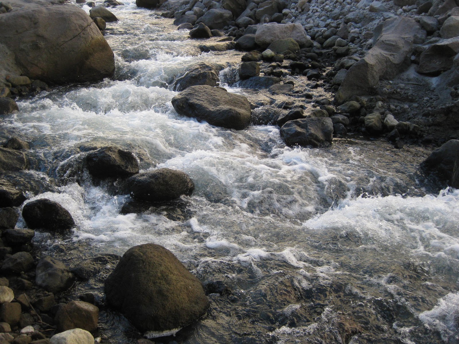 |
| Getting rocky and wet. |
 |
Rocky tracks and muddy too    Time to start trekking - no more ride from this point |
 |
| Jeep - machine power is down, leg power begins. |
 |
| Time for trekkers to use their leg power |
 |
| Trekking is not that easy. |
 |
| A long way to go. |
 |
| You look up - are these rocks - no they are part of the lahar formation. |
 |
| Can we keep my feet dry? |
Trekking through lahars filled ground.

A rocky scene when on foot
|
| A rocky ride ahead |
 |
| Looks smooth and clear - not too sure? |

Muddy scene ahead of us
 |
We are getting deeper - more rocks to cross. |
 |
| 20 minutes more to climb |
Here we are at Lake Pinatubo


 |
| The crater lake |
 |
| Another view of Lake Pinatubo |
 |
| Real hot day - kids have a cool deep in the river, not in the Lake |
Source:


